GÖRGÜÇ is a domestic desktop software that has been developed entirely with SDT resources for the processing of different aerial and satellite images. GÖRGÜÇ software features toolboxes to support the import of different types of data, and for image pre-processing/improvement, as well as smart target recognition algorithms.
Supported SAR Data Types:
- SARPER - National SAR sensor: STANAG 7023 format
- TerraSAR-X X band SAR satellite
- Sentinel C-Band SAR satellite
- Cosmo Sky Med X band SAR satellite
Supported EO Data Types:
- GÖKTÜRK satellite
- Sentinel-1 satellite

GIS infrastructure, data opening, zoom in/zoom out, basic measurements
Pre-processing (median filter, gamma filter, histogram equalization, specular noise reduction)
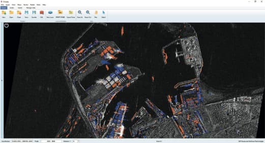
SAR-1: Analysis Tools (Terrain classification, road network, change analysis, shadow analysis, target detection, area similarity)
SAR-2: Target Identification (Aircraft, Ship, Bridge, Runway)
SAR-3: Expanded target list (POL, helicopter, tank)
SAR Interferometry-1: CCD (Coherent Change Detection)
SAR Interferometry-2: DEM (Digital Elevation Map)
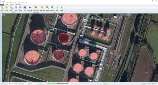
EO-1: Analysis Tools (Terrain classification, change analysis, area similarity)
EO-2: Target Identification: (Aircraft, Ship, Bridge, Runway)
EO-3: Expanded target list (Building and Hangar, POL and RADOM, Heliport, Tunnel Entry and Exit)